Cycling through BC’s Rockies
Guest post by Kane Mercer
The first part of my trip took me through the Rocky Mountains. The path was tough at times and the learning curve on this first leg of my trip was steep to say the least, but as I settled into my daily routine I became used to it.
![]()
I was overwhelmed by the natural beauty in this first leg. Often I would be in a forest and suddenly a mountain range would pop out in the distance. Sometimes the mountains were ominous because I knew that I would have to climb them later. Other times they were reminders of the ruggedness of this landscape. Regardless, the mountains were a constant feature which came in and out of my view.
Sometimes my bike broke down and I needed to get help. Every time I was in a situation where I truly needed help—whether it was bike repairs, a place to stay, or water—the people around me always helped. Over time I began to relax and rely on others around me more.
This is not saying that I needed help very often. British Columbia is quite safe and there are cities and towns really close to each other, so there weren’t many sections that were empty. This meant that campsites and shops were never so far away. One of the biggest problems I had with cycling through British Columbia, however, was in the very beginning.
On my first day I went from Victoria to Vancouver, where my older brother lives. I took the ferry and rode my bike towards downtown Vancouver but I soon discovered that that wasn’t as easy as I thought.
I had travelled from Vancouver to Victoria once before, so I figured it would be easy, but after following the signs I found myself in a predicament. There are two main ways to get to downtown Vancouver. The first is taking the Massey Tunnel and the second is the Alex Fraser Bridge. I had taken the Alex Fraser Bridge in Burnaby before, and decided this time I’d just follow the road signs and see what happens.
The signs led me to the Massey Tunnel. There is a shuttle I knew about that ferries cyclists from one side to the other, but I always assumed that the shuttle buses were in front of the tunnel. It wasn’t that case at all.
Before I knew it, I was in front of a “no bicycles” sign with no way to turn around. I had to take an emergency pull off, and in order to get back onto the road, I had to pull out in front of a solid block of fast moving traffic coming from the Massey Tunnel. Furthermore, there was no way for me to easily get back to where the shuttles were. In the end I chose to backtrack and went to the Alex Fraser Bridge after losing quite a lot of time.
These experiences happen in every trip, but they only accentuate all of the great adventures that happen along the way. I’d like to share and describe some of my favourite pictures from the time I spent rolling through BC to give an idea of what I mean.
This first picture is from when I was entering Vancouver on the first day. Although my camera didn’t capture it well, the sun was on one side and there was a rainbow on the other. One hour later I was to find a way through the Massey Tunnel to get to Vancouver.
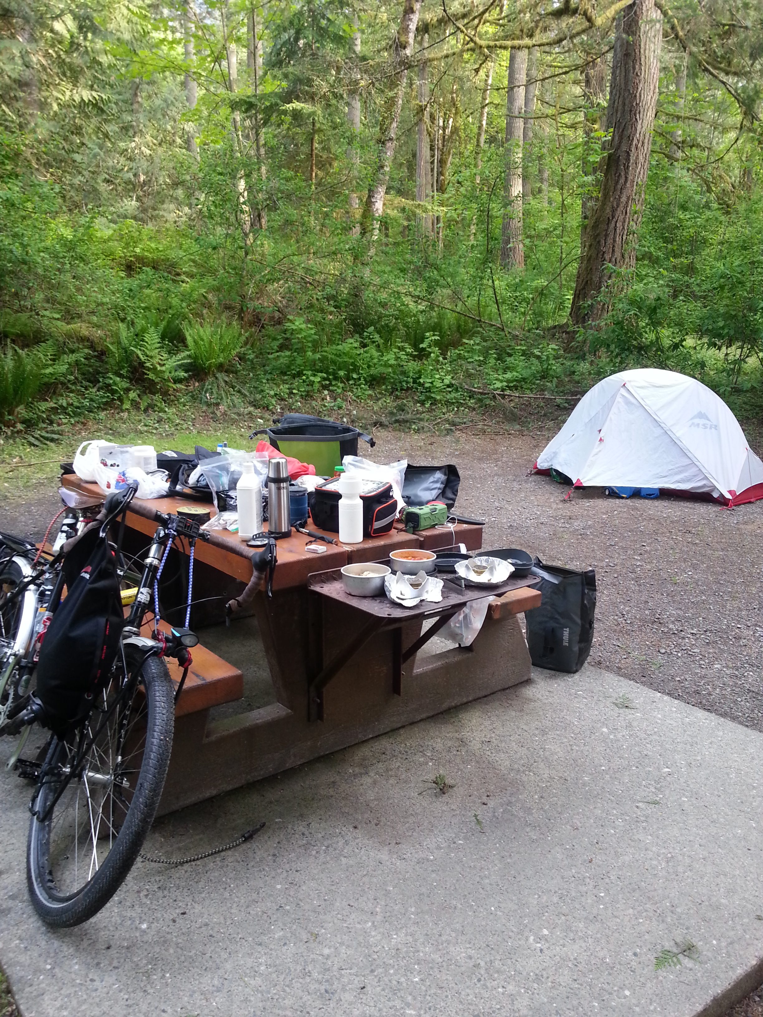
Here’s an example of my typical camp set up while going through BC. There were so many campgrounds, I would often take my pick and arrive early. This gave me plenty of time to make food. This particular site is the Cultus Lake Provincial campgrounds.
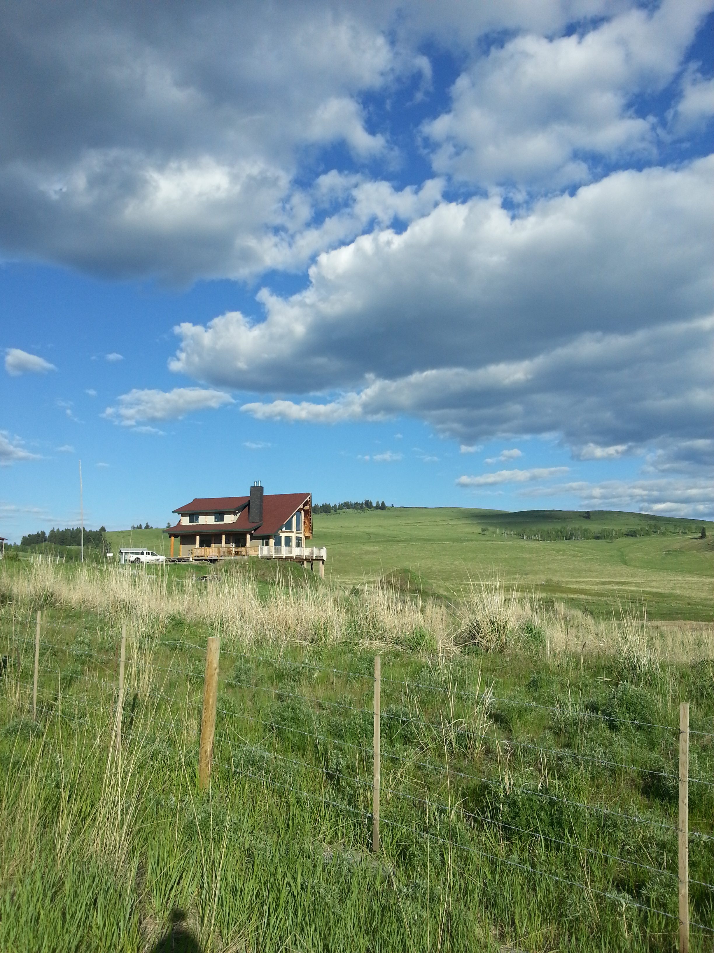
I saw this lone house in a grassy field not long after the Anarchist Pass in Osoyoos, BC. I thought it was really beautiful because of the way it stood out against the background. Other than this building there were only horses and cows and grassy fields. I would become more used to this later in Alberta, but in BC this was spectacular.
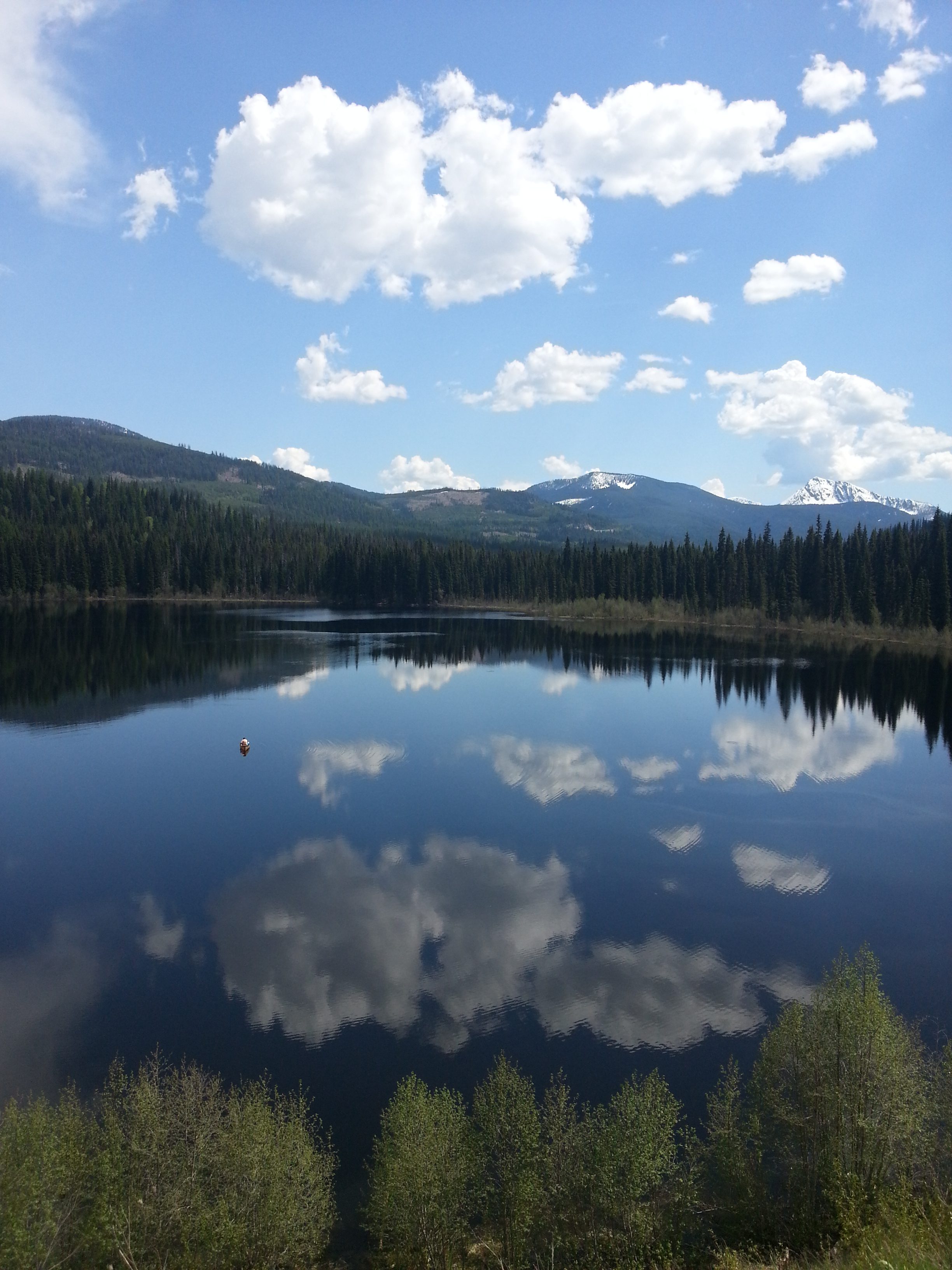
This lake was one of the most beautiful sights I’ve seen in this entire trip. There is a lone canoeist in the middle of the lake–and no wind– so the sky is perfectly mirrored on the surface of the lake. I was riding down a long hill after the Poulsen Pass, the second highest pass in Canada. When I saw this scene I just had to stop.

I took this picture on the 3A Road which runs between Nelson BC and Creston. In this area, there are beautiful hot springs called Ainsworth Hot Springs, which I highly recommend. Also, the free ferry to Crawford Bay was really nice. This scene was very beautiful so I decided to stop and take a picture with my bike.

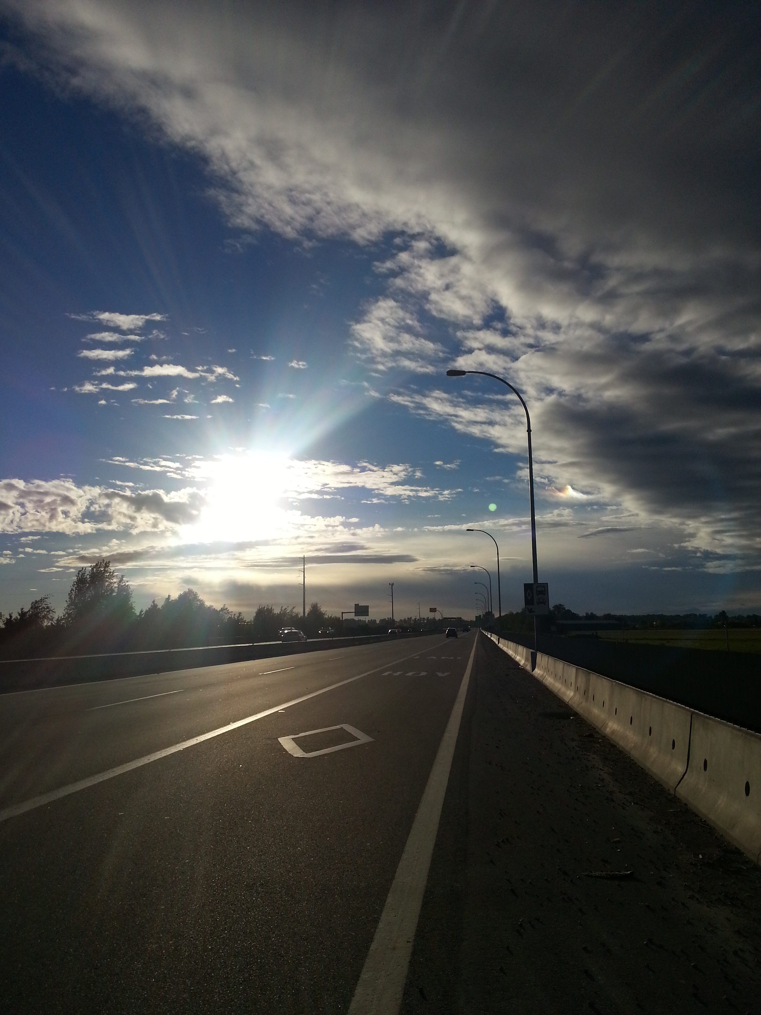
This is outside of Creston BC, right before a thunderstorm hit. At this time I was running away (or pedalling away) as quickly as I could before the storms arrived. You can see the clouds moving in in the picture even though it was sunny at the time.

This final picture was taken from the border between BC and Alberta. I was looking back on the mountains which I had just passed on either side while traveling through the Kootenay Provincial Park. That area is absolutely stunning and I recommend it to anyone.
To see my daily life in detail, please take a look at my blog where I take pictures daily. You can also donate to Victoria Hospice, as I’m doing this cross-Canada ride in honour of my dad.
Next: the rolling hills of the prairies.