There is part of a monologue in Six Degrees of Separation (an excellent film, by the way) in which the character, who is an artist talks of her frustration in her own art compared to that which her child brought home,
I remembered asking my kids’ second-grade teacher: ‘Why are all your students geniuses? Look at the first grade – blotches of green and black. The third grade – camouflage. But your grade, the second grade, Matisses, every one. You’ve made my child a Matisse. Let me study with you. Let me into the second grade. What is your secret?’ ‘I don’t have any secret. I just know when to take their drawings away from them.’
In the past, I felt a bit like those second grade students, having the drawing (digital collection) taken away, “before I was finished,” which led to personal disappointment. I am a researcher at heart, and after working with materials day after day I see connections, get excited, and want to share them (which is a big part of the reason I started this blog). Knowing what tools we have available, I would find myself constantly suggesting other things we could do with the materials and sometimes being reminded that we can’t do everything. More recently, I realized that we shouldn’t try to do everything either, because it is not our role.
The role of the (academic) library is to provide the raw materials for research and to describe those materials in ways that allow them to be discovered and used.
We don’t write the reports, theses, or projects based on the books in our collection or primary sources in the archives and there is no reason to think we should do anything different with digital resources. Our role is to ensure the best resources are made available to scholars and researchers. Once they have analyzed, interpreted, and built on those resources, we can then take their research and host that in the institutional repository, building an even larger pool of resources for future scholars.
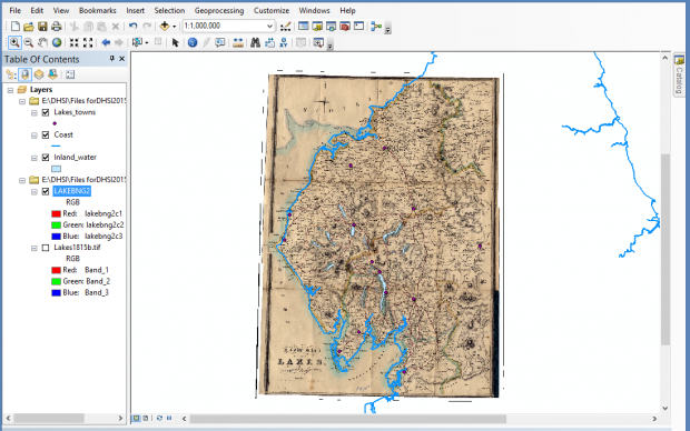
This week, I have been attending an intensive introduction to GIS (Geographical Information Systems) through the Digital Humanities Summer Institute, hosted here at UVic annually. I learned, among other things, how to align historical maps with current geographical data:
Naturally, I got all excited about the potential for GIS, thinking about our historical maps, and had to remind myself of the library’s role. While I may never apply the skills I have learned this week at work by building interactive maps, I can apply my understanding of what GIS users need to the way we develop the metadata templates and the kind of information we provide; the Library can add value to those raw materials through improvements to the description of the material.

