Spatial Modeling
Prof. Caterina Valeo, University of Victoria, valeo@uvic.ca, 250-721-8623
Whether predicting the concentrations of toxins and carcinogens in Vancouver Island’s working marine harbours, or modelling the relationship between the weather, climate and fecal coliform contamination in Vancouver Island’s nearshore areas, data science is essential to the credible to scientific discovery that supports engineering design. Fuzzy mathematics, spatial modelling, and Fourier analysis in conjunction with large data sets are used to determine potential risks and hazards from environmental pollution.
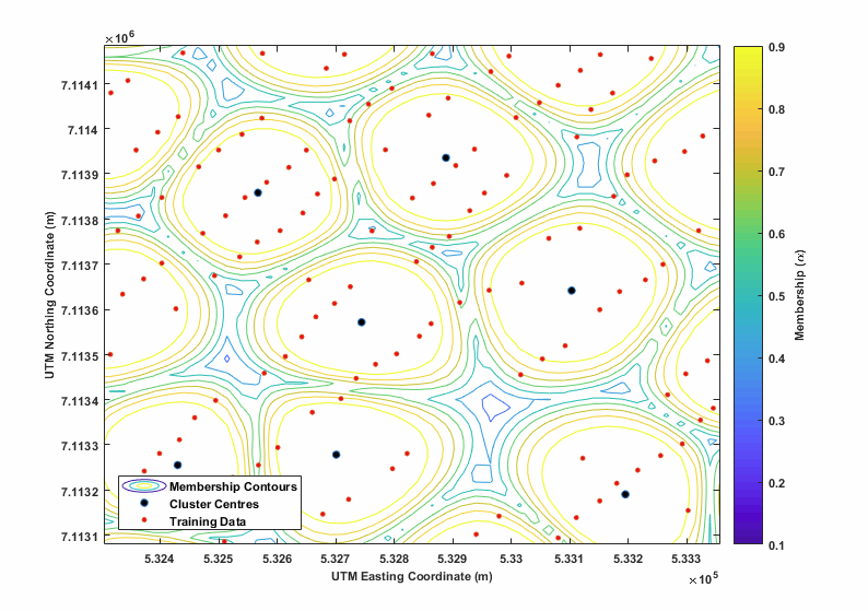


Image 1: A visual representation of lead contamination in a marine harbour that is clustered into fuzzy subsets. The collaborator on this project is Dr. Usman Khan, Adjunct in Mechanical Engineering, UVic, and Assistant Professor, Civil Engineering, York University.
Image 2: Fecal Coliform concentrations in Victoria’s nearshore area. The collaborator on this research is Dr. Jianxun He, Assistant Professor, Civil Engineering, University of Calgary.
Image 3: Relationship between average monthly fecal coliform’s and weather variables in Victoria’s nearshore area. The collaborator on this research is Dr. Jianxun He, Assistant Professor, Civil Engineering, University of Calgary.