
About
Welcome to Tram Fair? Mapping class onto the Greater Victoria Electric Railway. This website aims to show multiple maps to develop a new narrative of Greater Victoria’s electric railway from 1890 to 1948. The website will include cartographic snapshots in 1897, 1902, 1922, and 1939. The project will use David M. Boje’s evaluation of microhistory, which seeks to explore “historical causation” on the level of “little people.” The purpose of microhistory is “…to elucidate historical causation on the level of small groups where most of real life takes place and to open history to peoples who would be left out by other methods.” In our case, we will examine the people who road on and experienced Greater Victoria through the common-denominator of the streetcar. By invoking numerous, competing, but never dominant voices, our website also aims at “polyphony,” or “many-voices,” a concept employed by Mark Marino.
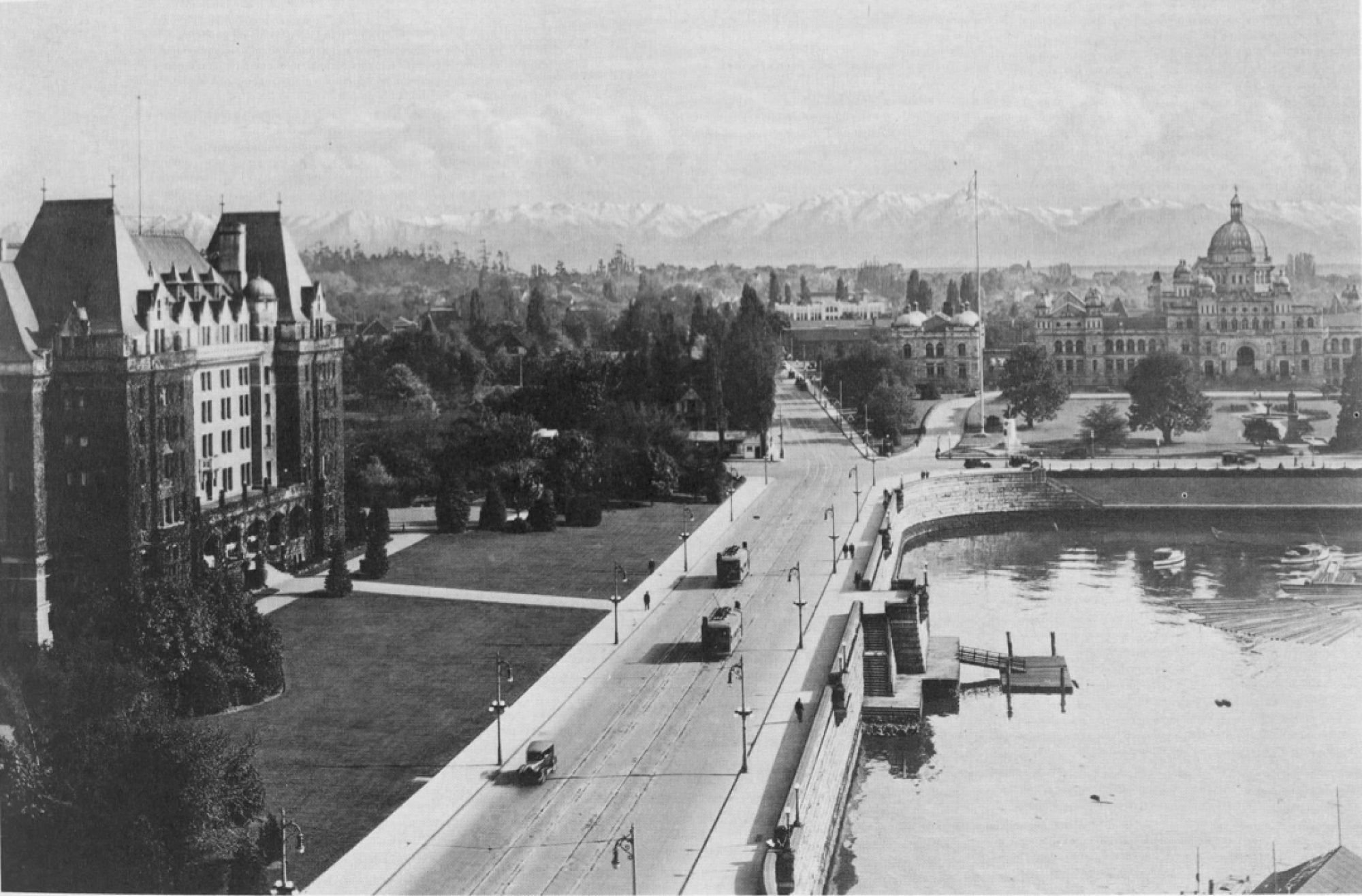
We will examine the maps of Greater Victoria’s streetcar tracks and their timelines in order to paint a better picture of who the streetcars served and why they serve the needs they did. Quantitative analysis, in the form of maps linked to census- and registry-provided addresses, will try to unpack the location of the city’s turn-of-the-century working class population in comparison with the areas serviced by the electric railways. Around the maps, in pop-ups and side menus, our website will tell the qualitative story: histories by authors such as Henry Ewert and Douglas Parker, along with primary sources such as interviews and written testimonies, will tell the story of how people engaged with the railway during its 58 year history, from its birth in 1890 to its demise in 1948. These sources will be used to temper the data we employ and give life to an otherwise storyless map of the city’s tramways.

Our website, despite being eclectic in its source material, has two objectives. Firstly, we would like to make the argument that, by and large, the laying of the streetcar tracks was done with commercial and specifically leisure-tourism aims in mind. The successive companies which controlled the streetcars in Greater Victoria were all privately owned, and their economic and social function seems to be best captured with a capitalist matrix in mind. While we will also aim to question these findings, believing that the humanities provide a space for discussion not definitive proofs, our website has been built with this valence, or bias, in mind. We do so in the spirit of David J. Bodenhamer’s injunction that “[t]he goal of research is not to eliminate explanations or to disprove the hypothesis but to open the inquiry through whatever means are available and by whatever evidence may be found.” In short, we will argue that the trams were economically oriented towards their respective termini (sometimes parks), and not towards the lines themselves. As such, urban commuters were underprivileged vis-à-vis the placement and construction of the tracks.
Secondly, our website intends to connect the local stories of the rise and fall of the tramways to the broader history of infrastructure and leisure, in tune with Joseph A. Amato’s comment that local history tends to avoid broader historical context and often treats local history as misleadingly unique to its locale. In showing both the local stories and the broader context, our website can attempt to challenge both a sterile master narrative of infrastructural progress and an overly-restrictive focus on local stories. In doing so, we may find that this approach can better expose inequalities and biases contained within the Greater Victoria streetcar network, as well as to open up the ways in which the streetcars were living places, with memories attached, and not just cold, steel-like moving space.


