Ian Predham

Denis giving one of his many informative lectures on Tseshaht history at Ts’ishaa, the named place of origin.

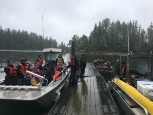
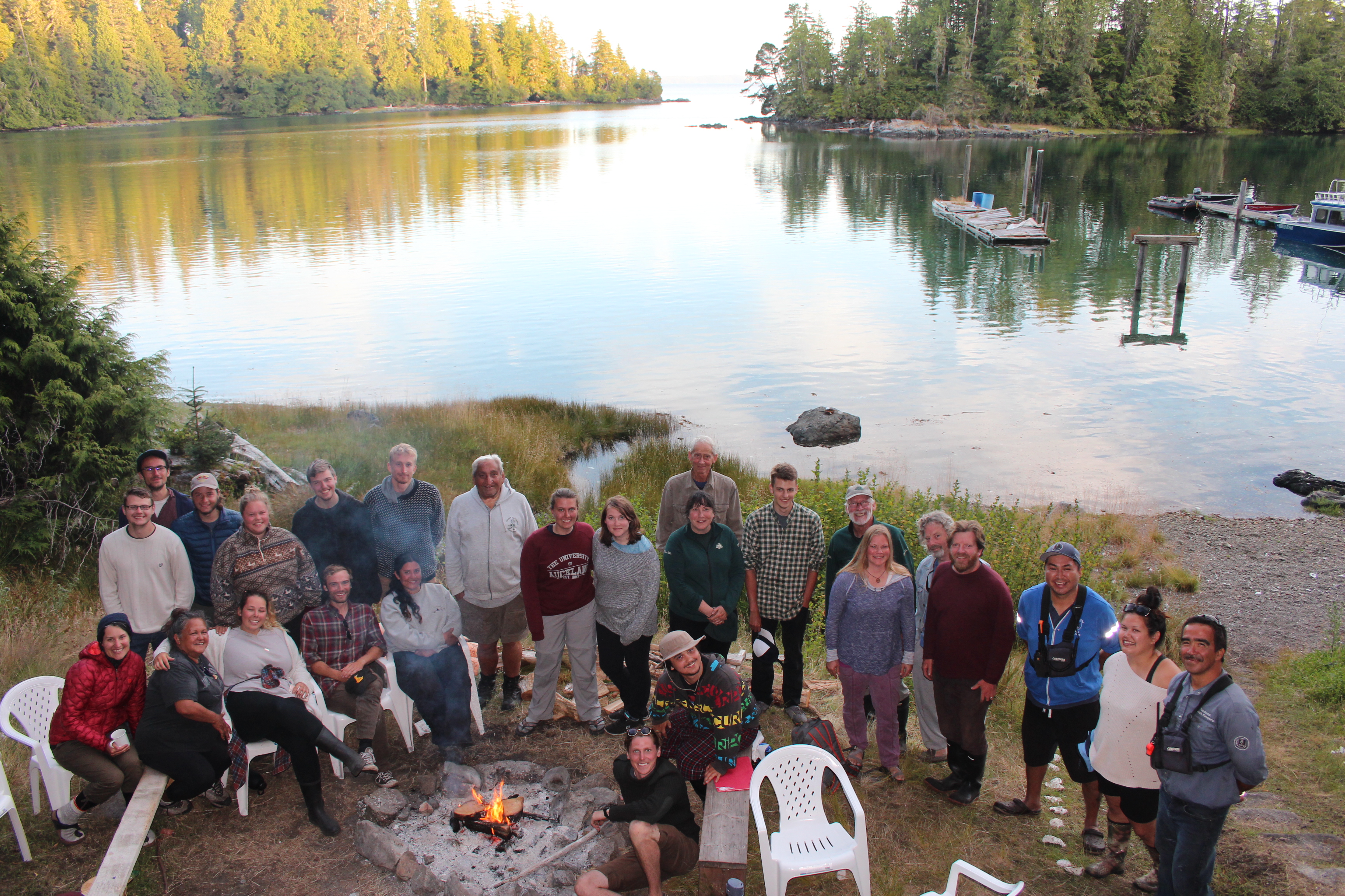
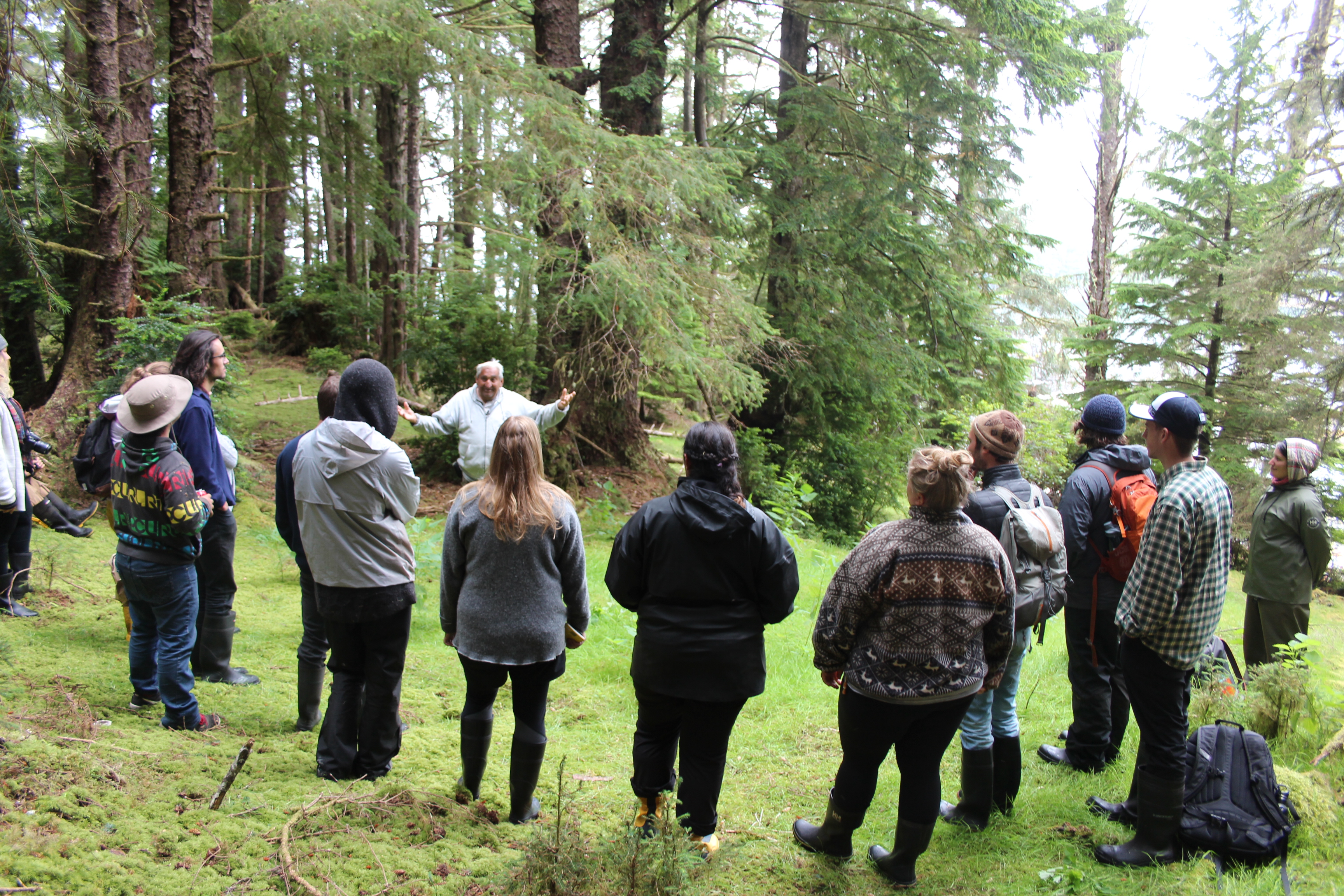
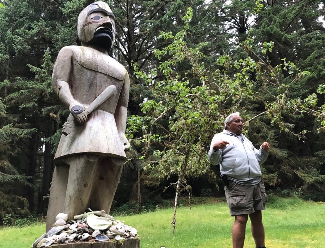
As we loaded our gear on the boats at the dock in Bamfield, I was filled with both excitement and anxiety. I had no idea what to expect from the next the 14 days living on an island in the middle of Barkley Sound with a group of people I had just met. Within the first couple days of getting oriented and situated with camp life I began to lose track of the days, fully immersed in the gorgeous landscapes of the Broken Group Islands and the research at hand. Our home for the past two weeks was Nettle Island, or Tl’ihuuw’a in Nuu-chah-nulth, which was once a thriving Tseshaht village. Camp life was made possible by our outstanding cook Wanda, Tseshaht First Nations community member whose mother was born at Kakmakimilh, a former Tseshaht village on the nearby Keith Island and the site of our excavation. Having someone who knew people who actually lived at the site we were excavating really put things in perspective for me. This wasn’t just an archaeological site with the sole purpose for research, this was once somebodies home, people were born here and had lived their entire lives here. Hearing stories of peoples lives at Kakmakimilh from Dennis during our lunch break was a constant reminder that we were guests here and extremely privileged to have the opportunity to work alongside the Tseshaht to uncover a part of their rich history.

Starting our excavation on KEITH island we set up two 2x2m units (EU 5 and 6), these units were chosen based on earlier probe tests that yielded what appeared to be a shell absent midden, exemplifying black greasy soil, characteristic of a typical midden matrix. I was assigned to unit 6 which was situated upon a downward slope. This made excavating our first several layers difficult, but provided us with the kinds of challenges in topography archaeologists must adapt to in order to perform effective excavations. Upon excavating our unit, we began to notice the absence of shell, fauna and any sort of cultural material. At the time this made myself and the others in the unit a little discouraged, but from the constant encouragement from the instructors, we learnt that patience and positivity among your excavation unit are fundamental aspects of archaeological research. After about 4 days of excavating, we had discovered what appeared to be an ancient shoreline, encountering isolated patches of sand in the matrix and an abundance of small water worn gravels. Additionally, in this beach layer we discovered what seem to be several chert flakes, with associated charcoal samples for radiocarbon dating.

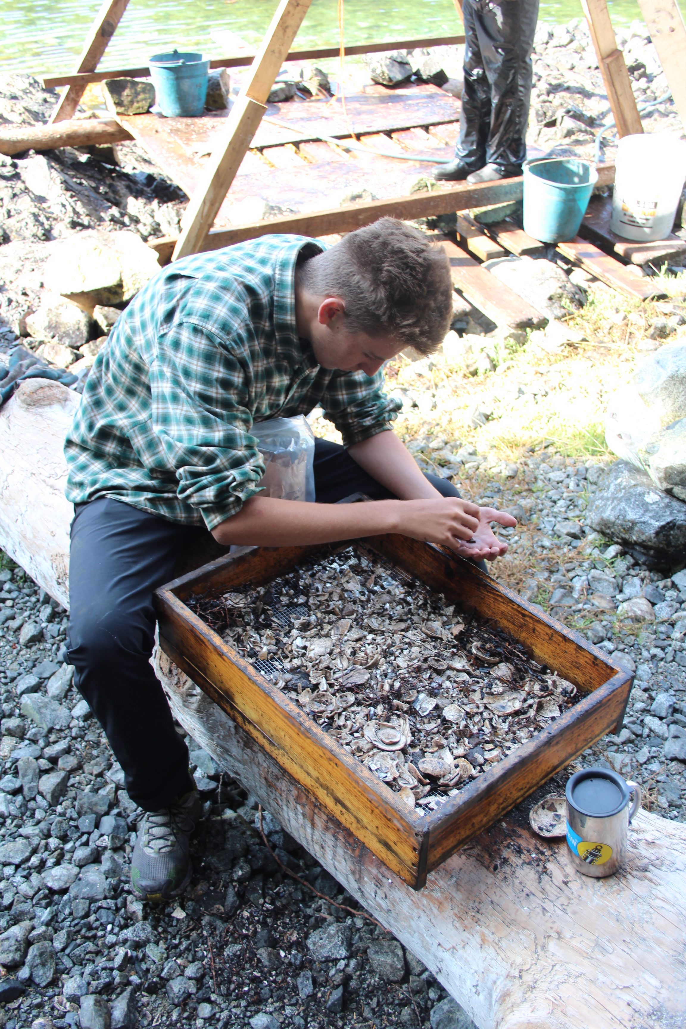
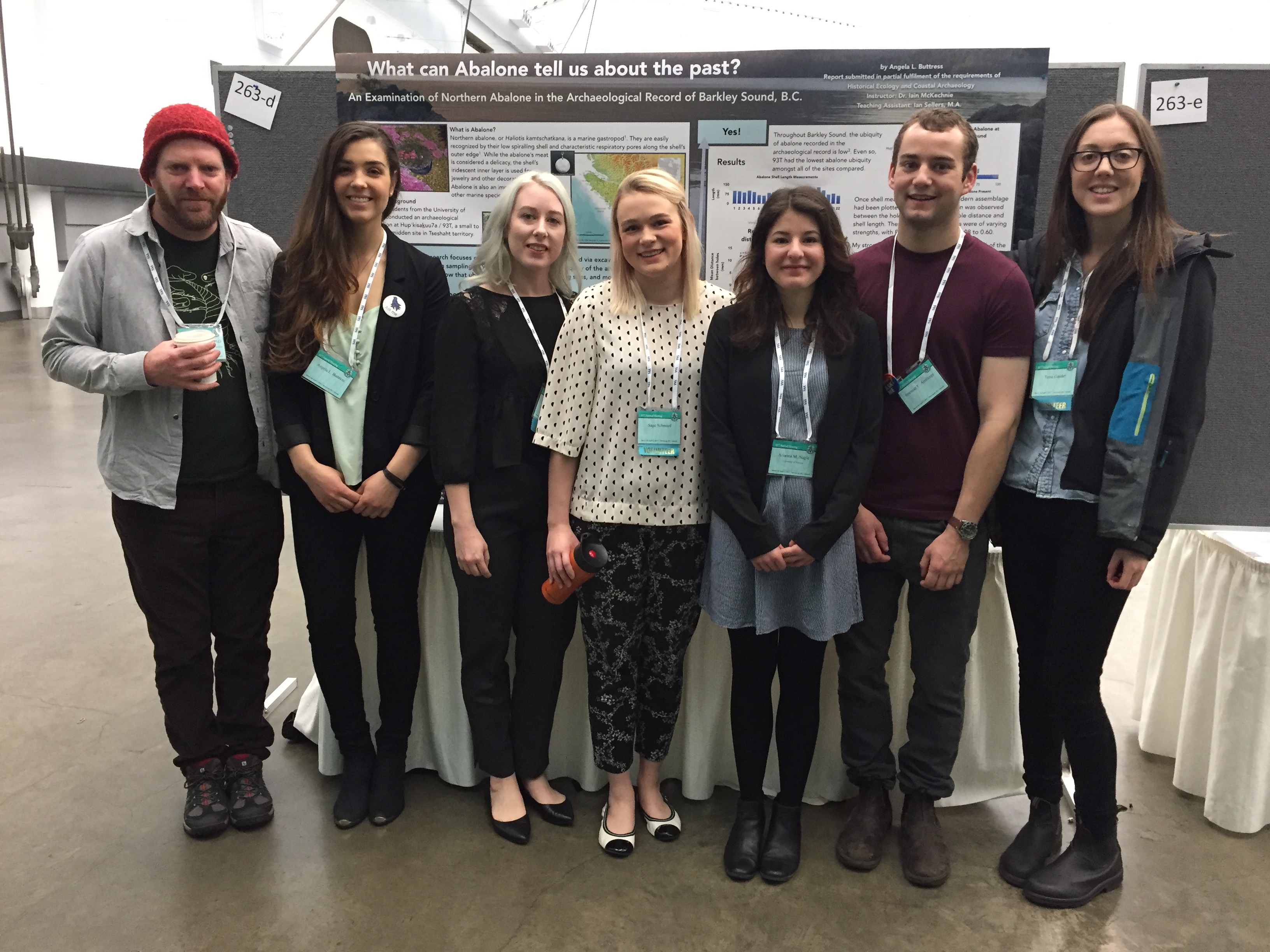
Continuing our excavations at Keith Island, we opened up two new excavation units 7 and 8. Unit 8 which myself and the others from unit 6 were assigned to, was located on the back of a ridge that ran parallel to unit 7. As a team, we decided where to situate our 2x2m unit, collectively agreeing that it would be best to intersect the sloping ridge. This would allow us to hopefully yield a rich deposit from the midden and have an indicative image of the stratigraphy of the overall site. Upon excavating our top layer, we encountered a moderate amount of historic artifacts, differing from unit 7 where historics were plentiful in the first layer. We then encountered the shell midden layer which to my excitement had a diversity of shellfish species. This layer was also home to an extensive amount of faunal remains, with bird, fish, land and sea mammal all appearing. Amongst the faunal remains we found several modified bone tools, including a deer ulna that had probably been used to pry open shellfish. Holding this tool in my hand was somewhat surreal, It was amazing to think that hundreds of years ago someone had hunted this animal, fashioned this tool and then used it to provide for their family.

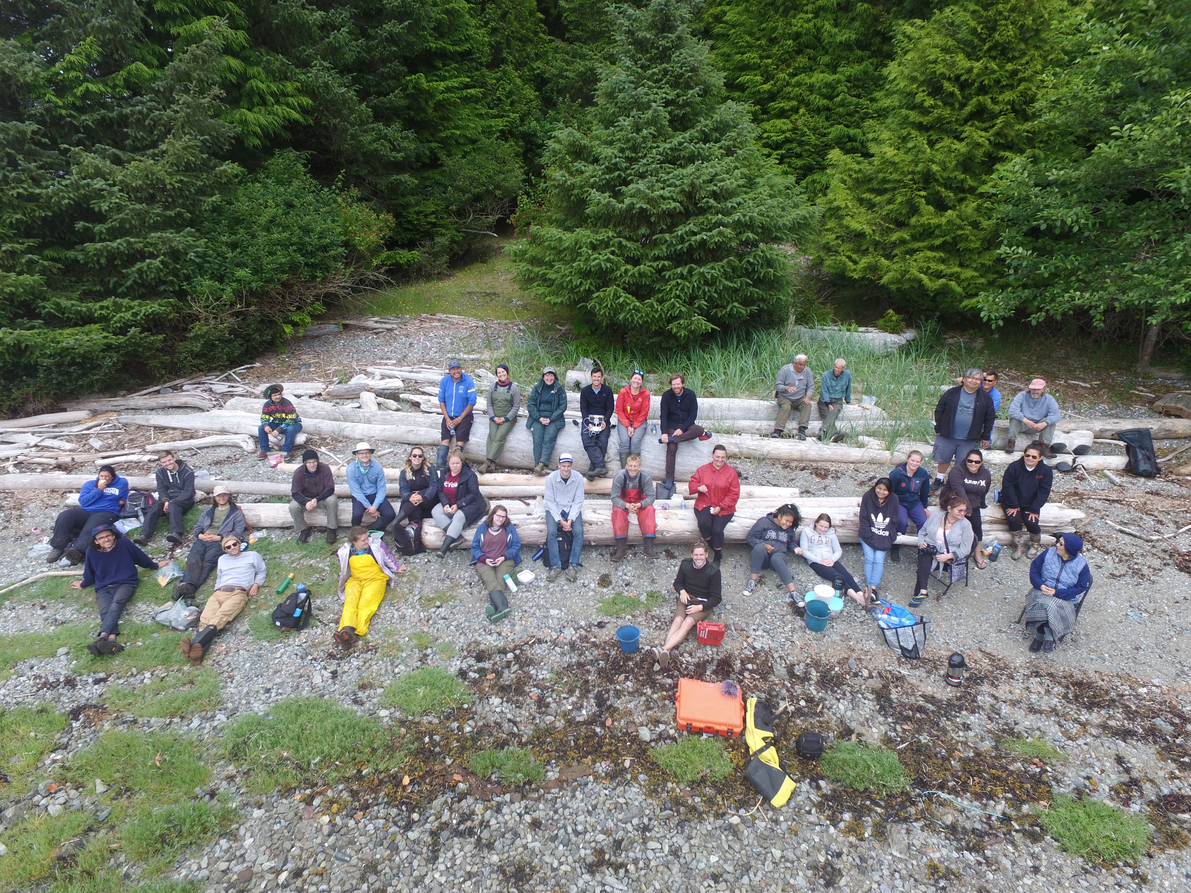
Spending this time in a place so unique with such a diverse group of people spanning cultural boundaries and many different fields of research made the last couple weeks truly special. Whether it was around the fire or during dishes, or having lunch at what Iain claimed to be “the best lunch spot in the Broken Group”, every moment of the past 16 days was made special by every person involved. The past few weeks in the Broken Group was overall a grounding experience that helped me grow as a person and taught me invaluable lessons and skills that will help me in future archaeological endeavors. Concluding my 2017 field experience I am grateful to everyone who made it possible, Kleco Kleco!

TJ Banghart

I have been on more boats in the past sixteen days than any other time during the last twenty-four years of my existence. If things go according to plan, I will have been on at least ten boats by the end of the week and hopefully more by the end of the field school. Although not totally unfamiliar with boats, the reliance on boating was a unique experience for me and has led me to reflect on two closely related concepts, landscapes and movement, and their relation to archaeological field work. In short, and perhaps surprisingly, boats have made me think about archaeology and, consequently, time differently.

Prior to our arrival on Nettle Island, we had been assigned a few readings about Barkley Sound archaeology and ethnography. These readings (particularly McKechnie 2015 and McMillan & St. Claire 2005) described pre-contact Indigenous life on the Broken Group Islands (BGIs) as being territorial wherein access to certain resources, locations, and knowledge depended on one’s cultural affiliation. Being unfamiliar with the area, I at first perceived each island as being simply another landmass within the larger archipelago. This was an oversight that was in some ways compounded by my ideas of “wild areas,” and “natural spaces” that I have inherited from romanticized notions of nature taught to me over the years and which I still find difficult to shake (cf. Cronon and “The Problem of Wilderness”). However, over the two weeks of excavation, which included a daily commute from Nettle Island to Keith Island, I had begun to become familiar with the subtle differences between the islands and water ways that connected them. My short time in the BGIs obviously pales in comparison to the more than 6,000 years of traditional knowledge and oral history developed by the Tsehaht and other First Nations who populate(d) the Barkley Sound area, but it nonetheless reified the earlier readings of socially bounded landscapes we had discussed and made me seriously question the limits of archaeological knowledge. This is to say that if it was not for the oral histories, ethnographic recordings, and living memories of the social boundaries and divisions that once characterized the BGIs, I believe it would be extremely difficult, if not impossible, to determine these aspects of the landscape from the archaeology alone.

A second, and perhaps more pragmatic, aspect of boating which left a lasting impression on me was simply how much stuff was needed to be carried to and from the docks every day. This was equipment essential to conducting archaeological excavation, our personal gear, the well-loved baked goods by our wonderful cook Wanda(!), and, among other things, people to actually put trowel to ground and make (hopefully) sound observations of what they saw. The sheer amount of things and bodies required to do archaeology in a remote region such as the BGIs came into sharp focus the last day of the field course when a classmate (Joey) and I carried the recovered artifacts for the season down to the dock to be loaded on a skiff. The entirety of our fifteen plus days of camping, cooking, dish washing, swimming, hiking, reading, talking, thinking, and (of course) excavation and inevitable backfilling, resulted in nothing more than a large ice cooler filled with bone, shellfish, and notes and a smaller tote with historic artifacts. The contrast between what we brought and what we returned with was striking and I am still wrestling with the question every archaeologist musk asks themselves: What did we just do and how can we make sense of it? Clearly archaeology is more than recovering the material remains of the past and the second half of the course will be devoted to putting things into context, or at the very least, developing some narrative from what we have found.

The UVic Field School is unique beyond its use of boats. It’s equal attention to traditional archaeological methods, pioneering approach to historical ecology, and incorporation of First Nation communities and oral histories into research is, to my knowledge, unprecedented. I sincerely thank Dr. McKechnie and Denis St. Claire for developing a field course that trains students to think (rather than dig) more deeply about the complex and intertwined relationship between humans and the environment. I know I have gained a considerable amount of insight into how to better conduct archaeological investigations as well as the importance of prioritizing living people and their unique histories when conducting research. I also sincerely thank Cody, Fred, Kevin, and the rest of the Tsehaht Beach Keepers for the wonderful opportunity to see more of the Broken Group than I would have and the Tsehaht First Nation for allowing us to study their history. Thanks also to the other field school students who have made the course an enjoyable and memorable experience.


Four boats loaded for our last voyage from Nettle to the Bamfield Marine Science Center. Not pictured is another boat that left a day earlier with the aforementioned excavated material as well as more project gear. Note the four burner oven to the right. We ate well out in the field. Thanks again Wanda!

2017 Fieldwork photos

Below is a quick view of our recent fieldwork in the Broken Group Islands, including some photos of the happenings. We are very fortunate to have had the support of many institutions and individuals for this opportunity.

2017 Group photo with the Tseshaht Beach Keepers and Parks Canada.
We had the privilege of visiting the 5,000 year old village site of Ts’ishaa, the named origin place of the Tseshaht First Nation.
Lunch on the beach during a Tseshaht Community trip to the village of Kakmakimilh on Keith Island as viewed from a Hakai UAV.
Micah wet screening in intense shell rich deposits with coffee nearby.

.

How to get there

BY ROAD

To get to ‘the field’ from Victoria, we plan to be travelling in a group to Bamfield. This will be a joint effort of caravanning and transporting personal gear and project equipment. The drive takes about 5 hours with a departure from paved road and then going slow on a gravel road for about two hours with twists and turns to Bamfield. We need to give ourselves a bit of extra time as we will be towing two UVic boats and need to gas up, eat lunch etc. That evening we plan to camp on the beach in Pachena Bay. The next morning, we will then depart the Bamfield Marine Science Centre docks and leave for the Broken Group Islands which will be our home for the next few weeks. This will involve transporting our field camp, field equipment, and camping gear as well as gas and water and food. Its a big effort but will serve us well in camp life:)

We will discuss the specifics of the route and caravanning during the first few days of the course.

BY COASTAL FERRY

For folks who plan to visiting us in the field (i.e., invited guests), there are multiple ways to get to the Broken Group islands. The most efficient method of pick up is to travel to the Sechart Lodge on the Frances Barkley from Port Alberni. This ferry departs from the Quay in Port Alberni at 8am and arrives at the Sechart lodge mid-day. It only leaves on every other day however – the detailed schedule is here.

We can then pick you up by boat at the dock which is near to our home basecamp on Nettle Island. Overnight visitors should make arrangements well in advance with the project directors (Iain and Denis) so we can coordinate pick up — particularly given this is a boat trip in the middle of the work day.

By BOAT from Bamfield.

The crossing from the Broken Group to Bamfield is sometimes difficult given weather and ocean conditions and since it is a longer travel distance, we will only make this trip infrequently during the fieldwork. However, when this happens it will be via this route and the docks at BMSC.

What we are reading

In preparation for venturing into field, it will be useful to delve into some of the publications about Nuu-chah-nulth archaeology in Barkley Sound. Below is a selection of the books, articles, and chapters that we will be referring to in our course.


Books

McMillan, Alan D. (1999) Since the Time of the Transformers: The Ancient Heritage of the Nuu-chah-nulth, Ditidaht, and Makah. UBC Press, Vancouver.

McMillan, Alan D., and Denis E. St. Claire (2005) Ts’ishaa: Archaeology and Ethnohistory of a Nuu-chah-nulth Origin Site in Barkley Sound. Archaeology Press, Simon Fraser University, Burnaby.

McMillan, Alan D., and Denis E. St. Claire (2012) Huu7ii: Household Archaeology at a Nuu-chah-nulth Village Site in Barkley Sound. Archaeology Press, Simon Fraser University, Burnaby.
McMillan, Alan D., Gregory G. Monks, and Denis E. St. Claire (2023) The Toquaht Archaeological Project: Research at T’ukw’aa, a Nuu-chah-nulth village and defensive site in Barkley Sound, Western Vancouver Island. International Series S3135. British Archaeological Reports, Oxford.

Articles

Hillis, Dylan, Robert Gustas, Daniel Pauly, William W. L. Cheung, Anne K. Salomon, and Iain McKechnie (2022) A Palaeothermometer of Ancient Indigenous Fisheries Reveals Increases in Mean Temperature of the Catch Over Five Millennia. Environmental Biology of Fishes 105:1381–1397.

McMillan, Alan D., and Iain McKechnie (2015. Investigating Indigenous Adaptations to British Columbia’s Exposed Outer Coast: Introduction to These Outer Shores. BC Studies (187):3–20.

McKechnie, Iain (2015) Indigenous Oral History and Settlement Archaeology in Barkley Sound, Western Vancouver Island. BC Studies (187):191–225.

McMillan, Alan D., Iain McKechnie, Denis E. St. Claire, and S. Gay Frederick (2008) Exploring Variability in Maritime Resource Use on the Northwest Coast: A Case Study from Barkley Sound, Western Vancouver Island. Canadian Journal of Archaeology 32:214–238.

Book Chapters

St. Claire, Denis E. (1991) Barkley Sound Tribal Territories. Pages 13–202 in Eugene Y. Arima, Denis E. St. Claire, L. Clamhouse, J. Edgar, C. Jones, and J. Thomas, editors. Between Ports Alberni and Renfrew: Notes on West Coast Peoples. Canadian Ethnology Service, Canadian Museum of Civilization, Ottawa.


HecArch at the 2017 SAAs in Vancouver

HecArch* made a splash at the 2017 Society for American Archaeology Meetings in Vancouver. Five posters by five students that emerged from their final student projects at Bamfield Marine Sciences Centre. Some photos below.

HecArch2016 powering through the Saturday morning posters at the SAAs. Angela Buttress’ poster in background.
Bree Bamford describing her poster results to a Canadian zooarchaeological hero, Professor Greg Monks.


Spencer Armitage representing @UVicAnthro and standing by the results from the column sample analysis – Way to go Spencer!

* the hashtag for Historical Ecology and Coastal Archaeology and the formal name for the course.

Getting to Bamfield

We will be departing from Victoria and heading to Bamfield turning off the Island Highway just north of Duncan, heading west toward Cowichan Lake. The road to Bamfield is Some drive on the south side of the lake through Lake Cowichan but I prefer the north via the town of Youbou.

Be sure to gas up in Duncan and drive safely on the logging road.

Depending on washroom and food breaks, and travelling slower than normal with boats trailers and gear etc., this may be an approximately a 5-6 hour drive, with perhaps as much as 2 -3 hours on a windy dusty logging road. We will aim to arrive at Pachena beach campground on the evening on Sunday July 10th.

consult this Bamfield Marine Sciences link for specific recommendations but note, I recommend the Youbou side of the lake.


NOTE watch out – slow down – and pull well over for large vehicles such as this:

logging_truck_02_640
photo credit – via ourbc.com