
Field Study: Stream Assessment of Lower Hobbs Creek and Tree Attributes for wildlife in Mystic Vale.

By Jennifer Rodriguez
Prepared for Dr. Richard Hebda
For the Restoration of Natural Systems Diploma Program
Course ER 312b Field Study in Ecological Restoration II
November 2021
Acknowledge
The author of this document acknowledges with respect that the University of Victoria is situated on the traditional territories of the Coast Salish and Straits Salish Peoples, specifically the Lekwungen (Songhees), Wyomilth (Esquimalt) and WS’ANEC’ (Saanich) Peoples. As the area addressed in this report has been an essential component of these peoples’ sustenance and way of life since time immemorial, it is essential that this plan be carried out in a manner that supports Indigenous ways of living and extends these words into meaningful actions.
I would like to acknowledge and express my gratitude to Dr. Richard Hebda and Dr. Nancy Shackelford.
Table of content
Table of content 3
1. Objective 4
2. Introduction 4
3. Methods and materials 6
3.1Data Collection 6
4. Discussion and recommendations 13
5. References 15
1. Objective
To assess the ecosystem health of Hobbs Creek and tree attributes for wildlife in Mystic Vale.
2. Introduction
The ecosystem health of Hobbs Creek was conducted to assess the current conditions and determine threats to the stream and riparian zone. Between 2001-2002, there were restoration efforts to increase the quality of habitat on the stream channel (Aqua-Tex 2009).
Current conditions indicate a high loss of riparian vegetation, soil compaction, erosion and spread of invasive species. All contributed to increasing humans and pets transiting the Vale trail on a daily basis.
The goal of this field study is to gather data and assess the current conditions of Hobbs Creek and tree attributes for wildlife use in the riparian area of Mystic Vale.
2.1Site description
The Mystic Vale and Hobbs Creek are located at 48 27‟35” N and -123 18‟24” W. In the southeast corner of the University of Victoria campus. The University of Victoria’s campus is located in the traditional lands of the Coast Salish People. Mystic Vale is located in two municipalities, Oak Bay and Saanich District.
The site is in the Georgia-Puget Basin Ecoregion, Southern Gulf Islands (SGI) Eco section. Coast Douglas-fir moist, maritime CDFmm biogeoclimatic zone of British Columbia, lies in the rain shadow of the Olympic Mountains and the mountains of Vancouver Island. As a result, it receives approximately 70 cm of rain annually and is characterized by a moderate climate with mild, wet winters and warm, dry summers.
2.2 Hydrology
Figure #1 Map of Lower Hobbs Creek
Hobbs Creek flows northeast from a municipal stormwater culvert on Cedar Hill Cross Road, down through a steep-sided gulley called Mystic Vale, then curves to the east/southeast through residential neighbourhoods near Cadboro Bay Rd., and discharges into the marine environment in Cadboro Bay. It also receives stormwater from a culvert under Parking Lot 1, which results in possible deleterious substances and runoff that would degrade the water quality of the creek.
Hobbs Creek is considered a flashy stream and can present a dry channel during the summer until early fall. Head cuts are frequent on the creek due to too high a volume of water during a short time. Sediment loading also occurs, with large quantities of sediment eroding from the stream channel and accumulating in areas downstream with lower velocity, such as pools.
3. Methods and materials
3.1Data Collection
The site analysis was done by identifying a reach spanning a length of 18.0 meters of Lower Hobbs Creek in Mystic Vale. Reach surveyed is located 114.0 meters south of gate access to Mystic Vale, situated at the end of Hobbs Street. Data was collected over a three-day period from November 12, 2021, from 10:00 to 14:00 (Water Quality, Stream Survey Cross-sectional survey, and stream discharge), November 13, 2021, from 9:00 to 14:00 (Longitudinal survey and habitat quality), and November 17, 2021, from 9:00 to 14:00 (Habitat assessment, and Tree attributes for wildlife).
Stream Assessment
I began measurements at reach, I referenced the site by setting a landmark using an existed water level gauge on the stream (Figure 1). The site length of the study was determined by measuring the stream bankfull channel width average is 1,5 meters twelve times is 18,0 meters (9,0 meters upstream from the gauge and 9,0 meters downstream of the gauge). I recorded the data using the advanced stream assessment habitat survey field data sheet (Streamkeepers Database).
I proceed to record water quality parameters using Extech EC500 Exstik II PH/Conductivity and TDS Meter. And C-100 Water quality tester to measure Salt %, Dissolved oxygen and temperature data summarized in Table 1.
Table #1 Water Quality Data
|
Parameter |
Upstream |
Downstream |
|
Temperature |
11.7 C |
10.0 C |
|
Dissolved Oxygen (DO) |
7mg/L |
11mg/L |
|
Total Dissolved Solids (TDS) |
109 ppm |
120 ppm |
|
PH |
6.44 |
6.6 |
|
Salt % |
0.01% |
0.01% |
|
Turbidity |
0.5 m |
0.2 m |
Temperature is an essential factor in assessing stream habitat quality; the average for the site was 10 ℃. Dissolved oxygen was between 7mg/L and 11 mg/L, which is good for most stream fish. Total Dissolved Solids were recorded at 109 pp and 120 ppm, which is considered hard water. The ph level was 6, which is the most recommended PH range for most fish species. Salt percentage value was 0.01% and lastly, turbidity ranged from 0.5 m to 0.20 of visibility.
To gather the data for the cross-sectional survey, I chose a water gauge located at the midpoint of the reach of the survey (9,0 meters), stretching a 2,0m tape between two wood markers to ensure that the tape is level and perpendicular to the stream flow, I recorded the bank full width and depth, and wetter width and depth were recorded. Depth was recorded at regular intervals across the stream points across the wetted width using a meter stick submerged into the water. The bankfull width was 1,5 meters, average bankfull depth 0,58 meters, wetted channel width 1,0 meters and average wetted depth was 0,6 meters (Appendix 1).
To calculate the stream discharge I measure the velocity in the riffle where I did the cross-section profile. I used an orange to determine how long it can take to travel 8 meters. Five trials were done as shown in Table # 2, decided that it took an average of 30 seconds to travel over 8 meters. The average velocity at the time of visit was 0.26 m/sec. Stream discharge was calculated by multiplying the cross-section area 0.30 m2 by the average velocity 0.2666 m/sec and by a correction factor of 0.8. Scream discharge is 0.063 m3/sec.
Table # 2 Stream Discharge
|
Cross-sectional areas of wetted stream (m2) |
1.0 |
0.3 |
0.30 m2 |
|
Wetted width |
Average wetted depth |
||
|
Average Time (sec) |
27+30+32+35+26= |
150/5 |
30 sec |
|
Trial 1+Trial 2+Trial3+Trial4+Trial 5 |
Total Trials/# trials |
||
|
Average Velocity (m/sec) |
8.0 |
30 |
0.26 m/sec |
|
Length of survey (m) |
Average Time (sec) |
||
|
Average stream discharge (m3/sec) |
0.30 m2 |
0.2666 m/sec |
0.063 m3/sec |
|
Cross sectional area (m2) |
Average velocity (m/sec) |
Discharge (m3/sec) |
The longitudinal survey was carried out over 18,0 meters. The upstream section is located 9.0 meters up the benchmark. Habitat unit pool consisted of one 8.0 meters long over a 4% of slope, resulting in a 90% of pool habitat and 10% riffle habitat occupying only 0.5 meters of the upstream section. The downstream area is located 9.0 meters down the benchmark. The pool habitat was around 6.0meter, with 60% occupying habitat with a 5% slope. Riffle habitat consisted of 3.0 meters with a 0% slope. The total pool habitat is 70%, a total of 14.0 meters of the survey area.
The percent of bedrock, boulders, cobble, gravel, and fines in the stream was determined by observing and obtaining 25 samples. Results were 50 fines, 30% gravel, 15% cobble and 5% boulder. The percentage of cover of gravel and cobble by fine sediment was 25% embeddedness. The findings suggest a less stable streambed with low-quality fish and aquatic invertebrate habitat. It was noted fine substrate accumulating on riffles and pools might indicate erosion problems that reduce Hobbs Creek’s productivity.
Large woody debris, or dead wood that had a diameter of 10cm or larger and over a minimum of 2 meters in length, was recorded in the wetted channel. The instream cover was 5 Large Woody Debris (LWD) on the left and 1 on the right bank. A total of 4 rooted cutbank was observed. The total in-stream cover was 12.
Off-channel habitats were not observed at the reach under assessment.
The section of the creek is located on a steep bank. 1 active bank erosion was observed on the right bank with a total length of 3.0 meters. Two sites with gully erosion in a total of 5.0 of the affected area. An area with signs of sliding reaching the channel of the creek was observed with a length affected of 1.0 m. This result means that half of the stream bank (9.0 meters of survey area) is moderately unstable.
Looking downstream, I assessed the vegetation from the left bank to the right; a total area of 3.0 meters on the right bank was noticed bare. The overhead canopy was 40%.
Analysis of the riparian buffer resulted in 2 channel widths on the right and 4 channel widths on the left. Coniferous trees observed were Douglas fir few, Deciduous trees such Bigleaf Maple, Red Alder was many, Shrubs observed were many Salmonberry, Red Elderberry, and Grasses few with a dominance of English Ivy (Invasive specie).
I used the Site Identification and Interpretation Field Guide for the Vancouver Region to determine the site series. The soil analysis was conducted about 1 meter from the creek edge by digging a hole about half a meter down and taking a sample from the exposed pit. By assessing the soil characteristics and using the hand texturing method of squeezing, the site was located on a low bench of the floodplain. I determined that the Soil Moisture Regime for the reach was 7 and Soil Nutrient Regime rich-very rich. Site series 10- Act-Willow. The tree layer was dominated by Red alder. Salmonberry, Red elderberry dominated the Shrub layer, the herb layer was dominated by English Ivy, and Electrified cat’s tail moss dominated the moss layer.
Tree Attributes for wildlife survey
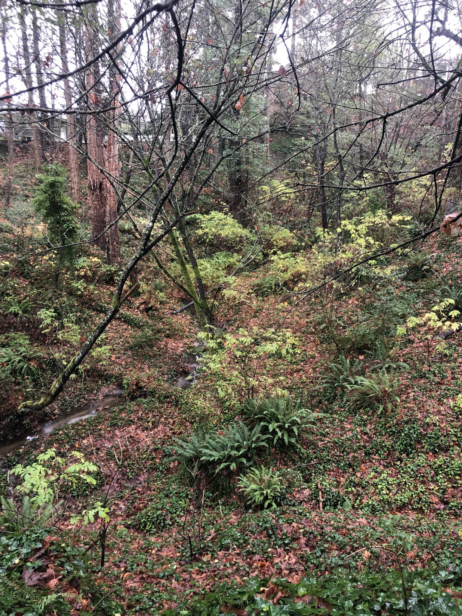
For examining tree attributes for wildlife, I selected to sample a fixed area of 2 acres along Lower Hobbs Creek (Figure #2). The Minimum diameter at breast height (dbh) will be 50 cm for this project. Plots were rectangular with five trees sampled. Wildlife trees were classified according to appearance, using a code (1-9). When a wildlife tree appeared to transition between two appearance codes, crown condition code descriptions were used as supplementary guidelines. Any standing trees that were noted to have woodpecker holes or standing trees that were detected to have nests were documented (Appendix 1-Tree Attributes for Wildlife form).
Figure # 2 Sketch of tree attributes for wildlife fixed area
Tree #1 Red Alder-Dr specie code, Standing with a dbh of 63 cm, Crown class was C-Codominant. The height of the to live crown was 10.0 meters. Wildlife code for appearance was 3-Dead with fine things present. Crown condition -2 (some foliage lost). Bark retention 4-Loose bark 55% remaining bark. The wood condition was 5-Most soft than hardwood. Lichen loading was 0 (no lichens). Wildlife use codes are C-Cavity nest, F-Feeding it was noted feeding holes and also split trunk.
Tree #2 Douglas-fir-Fd specie code, Standing with a dbh of 54 cm. The percentage of bark remaining was 100%. The estimated height is 20.0 meters. Crown Class D-dominant. The wildlife code for appearance was 2-Live. Crown condition 2- broken top. Bark retention 1-all bark present. The wood condition was 1-no decay. Lichen load 0-no lichen. Wildlife use was F-Feeding. User B-birds. It was noted fire mark possible indigenous burning practices.
Tree #3 Bigleaf Maple-Mb species code, Standing, with a dbh of 64 cm. The percentage of bark remaining was 80%. The estimated height is 12.0 meters. Crown Class I-Intermediate. The wildlife code for appearance was 4-Dead. Only coarse limbs were observed. Crown condition 4- 50% of branches lost. Bark retention 3-bare patches. The wood condition was 6-Spongy wood. Lichen load 5-lichen covered. Wildlife use was F-Feeding and P-Roosting. User B-birds and M-Mammal. Cancker was noted on the trunk of the tree.
Tree # 4 Grand-fir-Bg species code, Standing, with a dbh of 51 cm. The percentage of bark remaining was 50%. The estimated height is 5.0 meters. Crown was absent. The wildlife code for appearance was 7-Dead. Extensive internal decay with a hollow shell. Only 1/2 original height. Crown condition no branches. Bark retention 4-loose bark 50% lost. The wood condition was 6-Spongy wood. Lichen load 2-lichen covered. Wildlife use was F-Feeding. User B-Bird.
Tree #5 Bigleaf Maple-Mb species code, Standing, with a dbh of 80 cm. The percentage of bark remaining was 50%. The estimated height is 8.0 meters. Crown Class S-Supresed. The wildlife code for appearance was 3-Fine twigs are present. Crown condition 1- 40% of branches lost. Bark retention 4-bare patches. The wood condition was 6-Spongy wood. Lichen load 2-lichen covered. Wildlife use was C-Cavity nest. User B-birds.
Fauna observed during the assessment of wildlife trees includes Hairy Woodpecker (Picoides villosus), Northern Flicker (Colaptes auratus), Barred Owl (Strix varia), Red-breasted Nuthatch (Sitta canadensis), and Chestnut-backed Chickadee (Poecile rufescens).
4. Discussion and recommendations
The findings suggest that the reach assessed in this study shows no signs of restoration. The lack of native riparian vegetation is harming the health of Mystic Vale.
The most common habitat type for the reach was pool; there are few riffles within the stream. Large woody debris is also present along the stream banks. Common English Ivy (Hedera helix) make up most of the riparian ground cover. The creek channel and banks are eroded due to the loss of native riparian vegetation, soil compaction due to pedestrian and pet traffic and steep slopes from 20 to 30 degrees. There is a high risk of collapse of the edge of creek banks to the side of Mystic Vale trail.
During the winter months, the high volume of water and compaction of the soil from people and dogs is causing erosion and an unstable streambank along the creek edges. English Ivy climbing on trees poses a threat to tree health and increases the chances of creating hazardous trees. Stream Habitat assessment score was 55-Marginal. In-stream and off-stream characteristics that need restoration work are primarily:
- Streambed material: the reach will benefit from the addition of boulders and cobbles to provide better quality habitat for fish and invertebrates.
- Off Channel habitat: enhancement of habitat by creating side channels next to the main channels; will provide protection during flood flows for many species.
- Bank stability: Removal of invasive species, planting native vegetation, installing large woody debris and live staking.
- Riparian protection: highly compacted accesses to the creek should be closed using large logs and boulders to allow for the re-establishment of native vegetation.
- Invasive plants management: English Ivy should be removed by hand pulling to ensure native species grow and re-establish.
- Revegetation: riparian vegetation cuttings could be planted along the creek to increase vegetation covering and improve slope stability. Native herbs transplanted from nearby university property could help increase biodiversity.
- Tracking wildlife tree retention: retention areas serve as a protection for wildlife trees and other valuable ecological structures. Leaving rare or uncommon tree species is of utmost importance to biodiversity. If coarse woody debris is on-site, it is recommended to leave it as it serves as critical habitat for wildlife.
- Fostering a connection with stakeholders through stewardship activities will instil a sense of responsibility to reduce human impact on this sensitive ecosystem and spread awareness of the consequences of erosion and the spread of invasive species. Defining and designating areas for dogs is critical to reducing the impact on the creek.
Continuity of restoration activities is needed in Mystic Vale to promote a fully functioning ecosystem. As ecosystems are dynamic, changes due to climate change, new invasive species, and human impact can be challenging to anticipate. An adaptive management approach is essential to account for these unknown factors. To ensure restoration efforts are efficiently capitalized, further assessments are needed of areas that most require restoration.
5. References
Aqua-Tex: Scientific Consulting Ltd. 2009. Hobbs Creek-Mystic Vale Five Year Plan:
Restoration Priorities for Planning Purposes DRAFT for discussion. Aqua-Tex: Scientific Consulting Ltd.
EPA. 1991. Monitoring Guidelines to Evaluate Effects of Forestry Activities on Streams in Pacific Northwest and Alaska. EPA #910/9-91-001.
Fondriest Environmental Learning Center (2021) Water Quality Parameters. Retrieved on November 17, 2021, from https://www.fondriest.com/environmental-measurements/parameters/
Ministry of Forests (1994). A Field Guide for Site Identification and Interpretation of the Vancouver Forest Region: Land Management Handbook Number 28. Ministry of Forests, Victoria, BC.
Ministry of Forests (2010). Field Manual for Describing Terrestrial Ecosystems: Land Management Handbook Number 25. Ministry of Forests, Victoria, BC.
Pojar, Jim and Andy MacKinnon (eds.). 1994. Plants of Coastal British Columbia, including Washinton, Oregon, and Alaska. Lone Pine Publishing, Vancouver