For this project, Jacob and Paige relied heavily on three main sources: the City of Victoria directory, the census, and the Sefer Emanu-El book. They got a lot of their background information about the time period and prominent figures from the book, and cross-referenced that information with information from the directory and the census in order to figure out the home and business addresses.


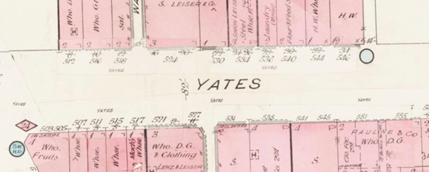
We then referenced the Fire Insurance Maps to figure out where the old addresses would be currently, and then figured out the longitude and latitude, and made an Excel spreadsheet with the old and new addresses, names, businesses, and coordinates.

We then used this data on Google MyMaps. This MyMap will serve as a tour through the Jewish community in Victoria in 1863, providing photographs and information about some of its residents and businesses. A picture of the map can be found on this website, alongside our answer to the question that we have based this project around. A link will be provided to our MyMap. We have also included a History page, which explains some of the history of the Jewish population of Victoria.